
Hiking and Paddling the Chesapeake on Maryland’s Lower Shore
- Laura Scharle

- Aug 15, 2025
- 6 min read
Updated: Aug 17, 2025

This is a sponsored post in partnership with Beach to Bay Heritage Area.
Hiking and paddling Maryland’s Lower Eastern Shore - particularly the lower Chesapeake region - is one of the best ways to develop a connection to the state’s heritage. Skipjacks, blue crabs, and Smith Island cake are all iconic state symbols that have deep roots here. It’s also a place of exceptional natural beauty, with what seems like endless sandy beaches and intricate labyrinths of marsh creeks to explore.
From the Wicomico River to the Pocomoke Sound, this corner of the Chesapeake offers some unique hiking options, ample paddling opportunities, and some of the best sunsets in all of Maryland. We’ve rounded up some of our top picks to help you get outdoors and connect with the heritage of the lower Chesapeake.
Whitehaven Ferry

If you’re entering the Lower Eastern Shore from the north, you’ll need to cross the Wicomico River at some point. Looking at a map, you’ll quickly notice that there are no bridges except in downtown Salisbury. This is because the City of Salisbury, located at the upper end of the river, is home to Chesapeake Shipbuilding, a ship construction yard that builds custom ferry boats, tugboats, and even small cruise ships! There is also quite a bit of boat traffic consisting of tugboats and barges, hauling materials up and down the river. If a bridge were to be constructed, it would have to be extremely tall. The car traffic on these rural roads is minimal, making it more efficient to operate a ferry. The Whitehaven Ferry enables motorists to cross the river in 5-7 minutes, instead of taking a 30-mile detour. The ferry also preserves some of the area’s heritage, as it is the oldest public continuously running ferry in the country!
Monie Bay Water Trails
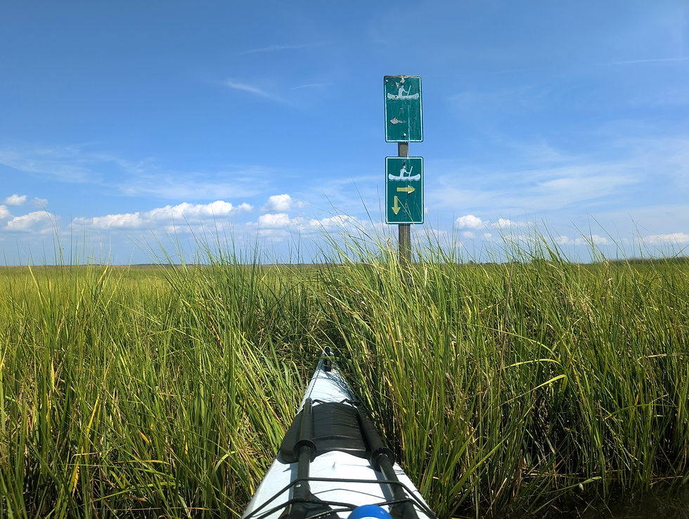
Located on the northeast end of Deal Island, several water trails have been established by the Chesapeake Bay National Estuarine Research Reserve (CBNERR). While the trails are marked with navigational signs, it is still highly recommended to have a GPS-tracking app on your phone to help you stay on course and not get lost in the labyrinth of marsh creeks.
Not only are water trails marked, but some of the signs also have numbers that correspond with various points of interest along the trails. Pair your trip with the official water trails map so you can learn more about muskrat lodges, a black-crowned night heron rookery, nesting barn owls, and much more. Please note that some of the numbered signs have faded over time, and you might need to get right up next to the sign to make out the number.
To access the Monie Bay Water Trails, launch from the boat ramp at Dames Quarter.
Deal Island Wildlife Management Area

Most wildlife management areas are known for their hunting and fishing opportunities, but there are some pretty unique hiking trails and paddling options at the Deal Island Wildlife Management Area (WMA). This large parcel of wetlands and impoundments is located between Deal Island and the mainland, spanning from the Wicomico River to the north and to the Manokin River to the south. Dikes surround the impoundment areas, offering raised walking trails surrounded by water and salt marshes. The trails are not marked but are usually well-maintained and easy to follow. Winter can be the best time to visit these trails to avoid biting insects, but be sure to avoid hiking during waterfowl and deer seasons. If you’re unsure of the hunting seasons, visiting on a Sunday is your best bet, as no hunting is allowed here on Sundays.
The waterways surrounding Deal Island WMA are perfect for paddlers too. In addition to the Dames Quarter boat ramp, there is also another ramp available at the south end of the property, providing access to the Manokin River and even more marsh creeks. There’s even a free campsite located on the right side of the road as you head south towards the boat ramp.


Deal Island is also a great spot to visit to really immerse yourself in the heritage of the Chesapeake. Deal Island was a thriving shipbuilding community during the 19th and early 20th centuries and is known for its ties to the iconic Chesapeake sailing vessel, the skipjack. A stop at the Skipjack Heritage Museum is well worth your time and visiting Deal Island on Labor Day Weekend is a real treat, when the annual skipjack race and festival are held. For those looking to just enjoy a great view, consider stopping by the public beach on Deal Island.
Frenchtown-Rumbly
Most Marylanders - and even most visitors to this area - have heard of Deal Island and Crisfield, but the town of Frenchtown-Rumbly might not ring a bell to as many. Tucked between the Manokin and Big Annemessex Rivers, this sleepy bayfront village is a must for paddlers and sightseers.
The boat ramp at the end of Rumbley Road is easy to access and has ample parking. One you launch, head in just about any direction, and you’ll either find stunning sandy beaches or winding marsh creeks to explore. There are no marked water trails here, so be sure to bring a form of navigation with you, whether it’s a compass, nautical chart, or GPS tracking app on your phone. Pat Island to the south is a highlight with its wild beaches, and all the marsh creeks in between are teeming with diamondback terrapins, small rockfish, clapper rails, egrets, and more. If you choose to stop and explore a beach, it is likely private property, so be respectful and stay below the high tide line.


When you’re sufficiently sweaty, salty, and exhausted, stop by the Goose Creek Pit & Pub for some fresh fish tacos and a cold brew on your way out of town.

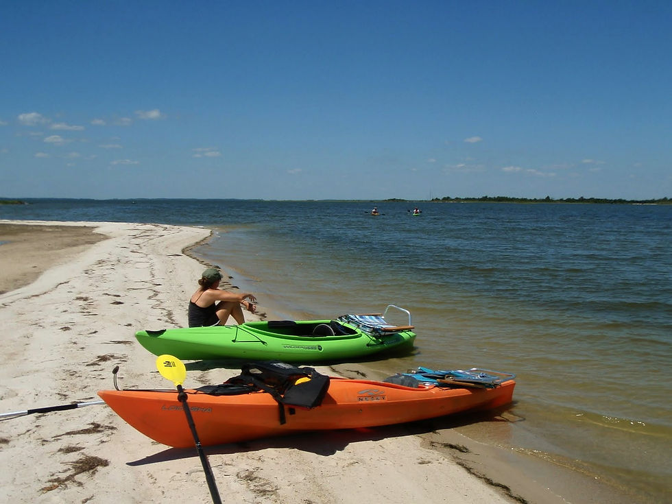
Jane’s Island State Park

If you enjoyed the marked water trails of Monie Bay and the beautiful beaches of Rumbly, you’ll absolutely love Jane’s Island State Park! The main park amenities, such as a campground, cabins, nature center, and observation tower are located on the mainland, but the main attraction of this park is the island itself.


Paddling the water trails and stopping at Flat Cap Beach to catch a sunset provide the most memorable experiences in the park. The island even has three paddle-in primitive campsites available. Kayak, canoe, and paddleboard rentals are available at the park and also through Kayak Crisfield. Stop in the park office to pick up a water trails map before heading out. Water trails are marked with signs and colored posts throughout the island.
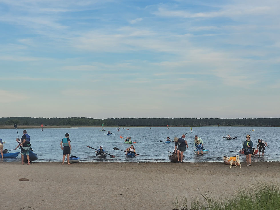
The park also holds an annual Paddlefest event each June. This popular event is a weekend packed with activities, from a poker run paddle and crabbing demonstrations, to live music and a campfire.

While you’re visiting the park, you can also do a little hiking along the White Tail Trail, but you’ll definitely want to bring your bug spray for this one if you visit in the summer!
Crisfield
Just a few miles down the road from Jane’s Island is the town of Crisfield, known as the blue crab capital of the world. The Crisfield town dock and Somer’s Cove can be bustling with activity, since this town is the launching point for many watermen and recreational boaters, as well as the ferries that head to Smith and Tangier Islands. Crisfield has an up-and-coming arts scene and a handful of cute shops and restaurants, so be sure to carve out a few hours to explore.
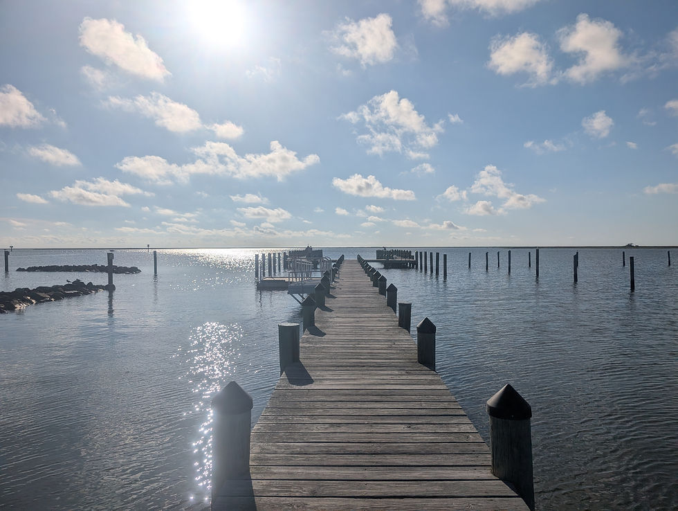
You may also want to consider making a detour off Route 413 to enjoy a bayfront beach and public pier. Wellington Beach is the perfect spot to take in a sunset, without needing to launch a kayak.

Crisfield is also home to the only true rail trail on the lower shore. The trail is currently 4.5 miles long, with plans to expand all the way from Crisfield up to Westover. Bike rentals are available through Kayak Crisfield and at Jane’s Island State Park.


Maryland’s Lower Eastern Shore is full of quiet places to paddle, hike, and connect with the region’s natural and cultural heritage. From water trails to historic ferries and villages off the beaten path, this part of the Chesapeake offers a slower pace and a chance to explore lesser-known spots. Whether you're on foot, bike, or kayak, there's plenty to discover.
To learn more about the natural and cultural heritage of the lower Chesapeake, be sure to check out the Beach to Bay Heritage Area and consider participating in their passport program!


