
Top Outdoor Excursions Along the Pocomoke River
- Laura Scharle

- Aug 15, 2025
- 7 min read
Updated: Aug 17, 2025
This is a sponsored post in partnership with "Beaches, Bays, and Waterways," the Lower Shore Heritage Area.
The Pocomoke River and its watershed make up the ultimate playground for outdoor enthusiasts on Maryland’s Lower Eastern Shore. The Pocomoke is the perfect backdrop for camping, fishing, paddling, hunting, birding, hiking, and even mountain biking.
The Pocomoke is unlike any other river you’ll find on Delmarva. While most of Delmarva’s tributaries seem to be framed by salt marshes, loblolly trees, or waterfront homes, you won’t find many of those things along this waterway. The river’s shorelines are dominated by ancient bald cypress trees, and the riverbanks are largely undeveloped, since the river is surrounded by the cypress swamp, public lands, and a nature preserve. As you explore the quiet bends of the river and the surrounding wild landscapes, it’s easy to imagine members of the Pocomoke Nation, a sub-tribe of the Algonquin People, paddling log canoes through the swamp, and to picture Captain John Smith first charting these waters during his 1608 exploration.
The word “Pocomoke” is an Algonquin Indian word that means “black water.” When you visit the river for the first time, that’s one of the first things you notice-–the water is very dark. This is due to tannins that are released from decaying vegetation, typical of bald cypress swamps. Another feature that sets the Pocomoke apart from other nearby rivers is its depth, which ranges from 8 to 45 feet. And compared to other Chesapeake tributaries like the Choptank and the Potomac, the Pocomoke River is very narrow, making it the second deepest river in the world for its width!
From the headwaters in southern Delaware to where it meets the Pocomoke Sound, the Pocomoke River is about 70 miles long, but the lower 35 miles have the most access and opportunity for all kinds of adventuring. Beginning down by the Virginia state line, let’s take a tour upstream of all the outdoor recreation opportunities this river and its watershed have to offer.
Shelltown & Pitts Landings
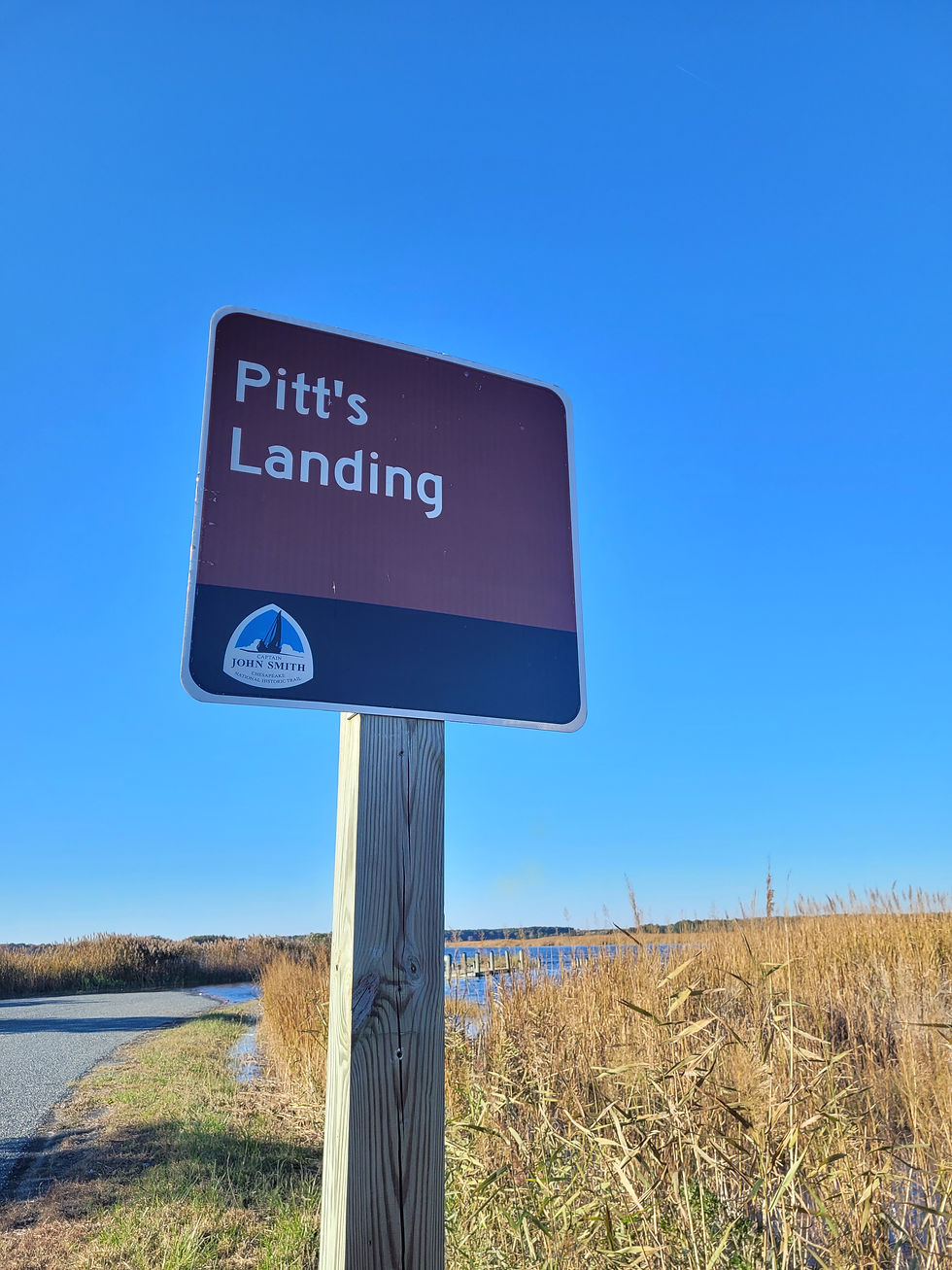
Shelltown Landing provides access to the Pocomoke River right at the mouth as the river meets the Pocomoke Sound and the Chesapeake Bay. There is another launch slightly upriver on the opposite riverbank called Pitts Landing, and although it’s located in Virginia, it can be easier to drive to since it’s on the same side of the river as Route 13.
Launching at either Shelltown or Pitts Landings provides access to a scenic, narrow creek called Pitts Creek, which is out of the way of most boat traffic in this area. The creek repeatedly twists and turns for several miles as you make your way upstream. Virginia Water Trails has a great map that shows the creek.
Hickory Point Natural Area
As you head upriver from the Pocomoke Sound, you’ll start to notice the vegetation changing from estuarine wetlands to the Pocomoke’s signature bald cypress swamp habitat. About eight miles upriver from Shelltown and Pitts Landing is the Hickory Point Natural Area. This property is managed by the Maryland DNR Wildlife & Heritage Service, and while you may be able to explore some of the wetland creeks, it can also be explored by land and can be accessed by a trailhead on the east side of the river. The trails are not well developed or clearly marked, as most of the trails are old logging roads, but if you’re really looking for a wildlife-filled hike that’s far off the beaten path, Hickory Point is perfect. Please be aware that this property is hunted; wear bright colors and avoid hiking during firearms seasons.
Pocomoke City & Dividing Creek
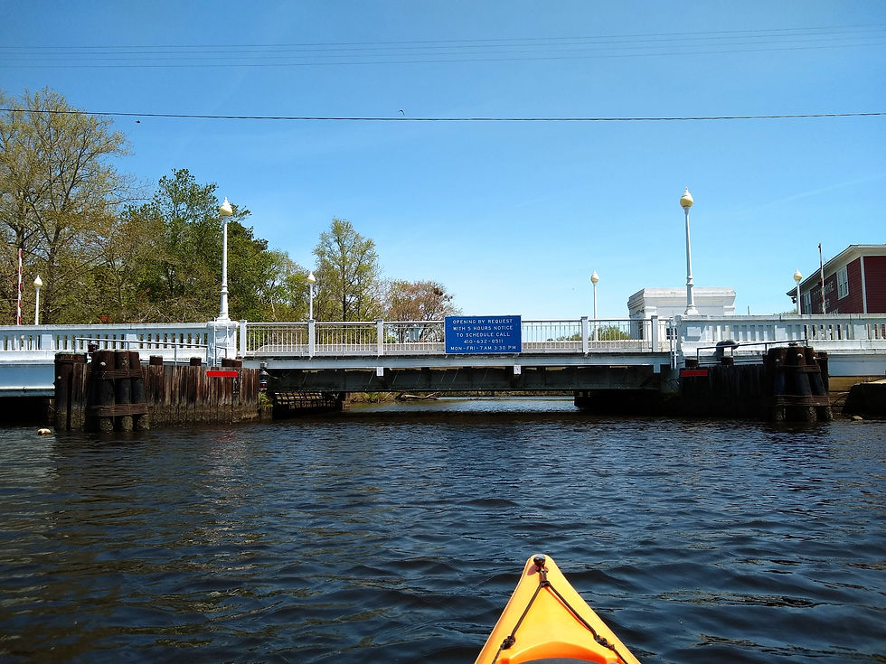
The first incorporated town you’ll encounter along the Pocomoke River as you head upstream is Pocomoke City. Although Pocomoke City was referred to as Stevens Ferry in the late 1600s and later incorporated as New Town in 1865, the name Pocomoke City was established in 1878. The city has a charming downtown historic district and includes some fascinating history, such as the Delmarva Discovery Museum, the Sturgis One Room School and Heritage House, and the Mar-Va Theater Performing Arts Center.


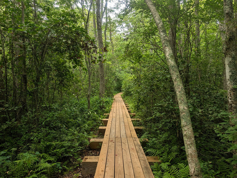
Although the word “city” probably doesn’t conjure up thoughts of paddling and hiking, there are opportunities for both within the city limits! The Pocomoke City Exercise & Nature Trail begins right next to the drawbridge, passes along the river, meanders through the cypress swamp, and wraps around a pond, providing over a mile of trail to explore.
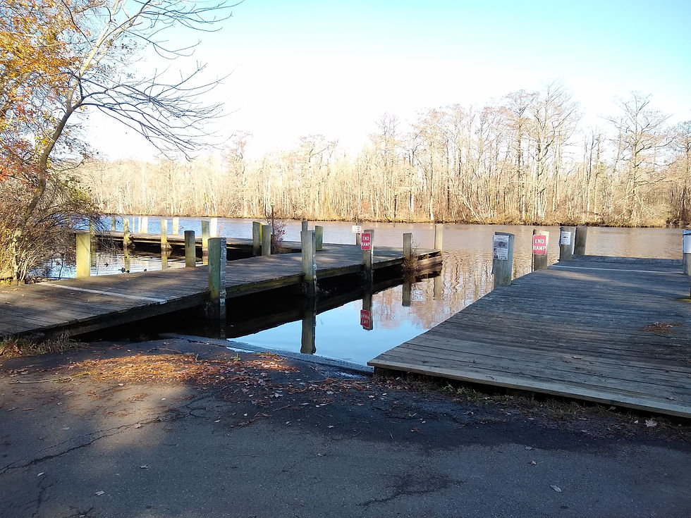
Just a stone’s throw from one of the trailheads is a boat ramp and fishing pier located at Winter’s Quarter. For paddlers looking for an adventure off the beaten path, head upstream from the ramp for about a mile and turn left into Dividing Creek. This narrow creek is just wide enough for paddlers to get by, yet it is incredibly deep. This area is packed with wildlife, from deer sightings to the occasional barred owl calling in the distance. It’s important to note that fallen trees can sometimes be tricky to navigate around, so be prepared for an adventure!
Hudson-Tarr Mountain Biking Trails
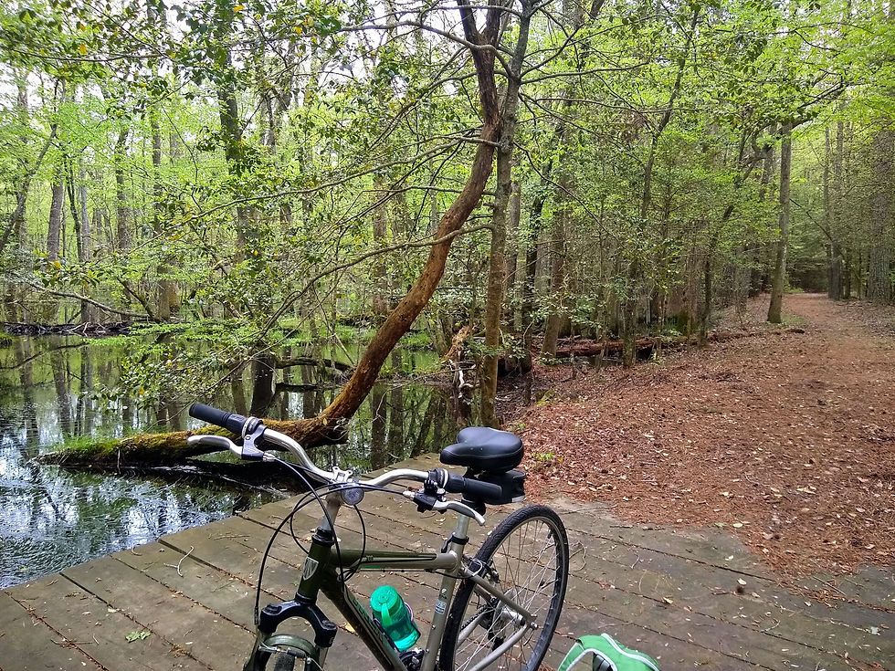
You’re probably giggling to yourself as you’re reading this section because mountain biking on the eastern shore sounds pretty impossible since the land is so flat and close to sea level. But just five miles upriver from Dividing Creek is a whole network of mountain biking trails located in the Pocomoke State Forest. The Hudson-Tarr Mountain Biking Trails have several trailheads along Route 113, but the easiest spot to access the trails is on Blades Road. From here, you can access over eight miles of singletrack mountain biking trails through the state forest, perfect for cyclists that are just starting out.


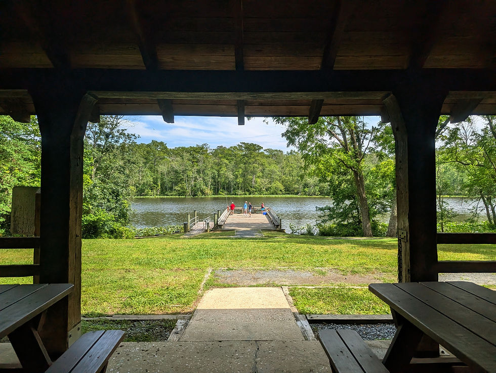
Pocomoke River State Park
The state park is probably the most well-known area to explore the outdoors along the Pocomoke River. Pocomoke River State Park has two access points, Shad Landing and Milburn Landing. Although they are only 3.5 miles apart, they are located on opposite sides of the river, creating a 25-minute drive between them.
Shad Landing is known for its small marina, the scenic Trail of Change, and the Corker’s Creek Water Trail loop. Kayaks and canoes are available for rent during the peak season, and Corker’s Creek is perfect for beginner paddlers since it’s protected from wind and boat traffic.

Milburn Landing has a large fishing pier, the Bald Cypress Trail, and easy access to the Milburn Landing Trail within the Pocomoke State Forest. Both Shad and Milburn Landing provide a variety of opportunities to experience the river and the stunning ecosystem of the cypress swamp.
Pocomoke State Forest
The Pocomoke State Forest is likely the largest tract of public land across the entire lower shore. It’s so large that it can easily be spotted on satellite imagery because it’s a giant patch of woods amongst neighboring towns and farms. As already mentioned, the Milburn Landing Trail and the mountain biking trails are excellent places to explore the forest. If you are looking for even more hiking options, you’ll definitely want to walk the 4-mile orange loop, the 1.8-mile yellow loop, the 5-mile blue and green trail system, and the 2-mile red loop. All of these trails are located on lands that are frequently hunted, so avoid hiking during firearms seasons, and be aware that hunters may be on the property during other seasons, such as turkey and small game. For safety tips, visit our helpful tips page.


Nassawango Creek Preserve
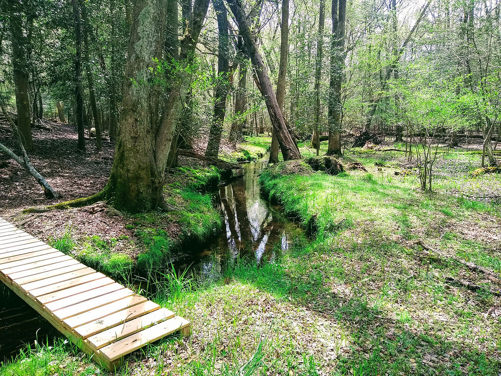
But wait, there’s more! If state parks and a state forest aren’t enough to explore, venture on through the Nassawango Creek Preserve, a property managed by The Nature Conservancy. The preserve consists of several tracts of land scattered mainly between Snow Hill and Salisbury. The two trails that are closest to the Pocomoke River are the Nassawango “Joe” Trail and the Prothonotary Warbler Trail. As you might expect from the trail name, Nassawango Creek Preserve is known for high concentrations of prothonotary warblers during spring migration season. These bright yellow birds can best be spotted in spring and early summer along the trails and while paddling Nassawango Creek, a tributary of the Pocomoke River.


A few portions of Nassawango Creek Preserve are designated Old Growth Forests, where huge, ancient trees that have been minimally disturbed by humans can be found. In fact, the preserve is home to the second largest bald cypress tree in Maryland.
Snow Hill
Less than two miles upstream from Nassawango Creek is the Town of Snow Hill. Snow Hill was established in 1686 and has been the county seat since 1742. Among its historic attractions is the Julia A. Purnell Museum, where visitors can learn about the town’s rich past. Today, the downtown historic district is home to a variety of shops, restaurants, and the Pocomoke Canoe Company - the only paddling outfitter on the river. Here you can rent canoes, kayaks, paddleboards, and small jon boats to explore the river. Their staff will even shuttle you to the top of Nassawango Creek or several miles up the river to Porter’s Crossing so you can paddle a one-way route back to their shop. They’ll even provide shuttles for those who have their own vessels!


If you want to get outdoors in Snow Hill but don’t want to hop in a canoe, head to the south end of town to hike the three miles of Summerfields Trails, another tract of the Pocomoke State Forest. Park at Byrd Park and follow Ball Park Rd, Cypress Ln, and Dighton Ave to get to the trailhead.
From paddling beneath ancient bald cypress trees to cycling quiet forest trails and exploring charming river towns, the Pocomoke offers a uniquely wild experience on Maryland’s Lower Eastern Shore. With so many ways to enjoy its beauty, it’s a place that will take you days–-or weeks—to truly experience to the fullest.
To learn even more about the natural and cultural heritage of the Pocomoke River, be sure to check out the Beach to Bay Heritage Area and participate in their passport program.


